This post contains a compilation of several maps of Lower Manhattan, specifically the Financial District, to help you navigate and find out what there is to see and do in NYC's Financial District.
- Tourist Map
- Map of Wall Street
- Map of Battery Park
- Map of the World Trade Center
- Maps of NYC Neighborhoods
- Things to Do in Lower Manhattan
TOURIST MAP OF THE FINANCIAL DISTRICT
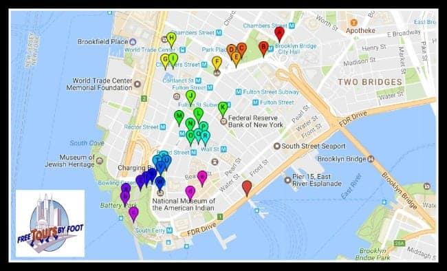
This map is our self-guided tour map of the Financial District. Lower Manhattan is actually made up of several additional neighborhoods (we have maps for all of them here).
The map below is interactive. You can enlarge it. You can use it on a smartphone. Each lettered pin contains images and text explaining each location.

Below are maps highlighting smaller areas of Downtown Manhattan.
Why not take our GPS-enabled audio tour of the area? It's just $1.99 and includes a map.
We also offer a free, downloadable, printable, PDF version of the self-guided tour.
The MTA (Mass Transit Authority) also has a subway and bus map of Lower Manhattan.
If you are unfamiliar with public transport in NYC, then be sure to read our posts on how to use the NYC subway and which MetroCard to buy.
Of course, many of the hop-on-hop-off tourist buses make stops throughout this area.
If you are considering using these tourist buses while in NYC, then be sure to read our bus tour comparison post.
Read more about the things to do in the Financial District.
Below, we get more granular with both the Wall Street and Battery Park areas.
Some of the other major tourist attractions in this area include:
Many of the attractions found in Lower Manhattan are included for free or at a concession with the purchase of all NYC tourist concession passes.
Read our post on whether or not a tourist pass is for you.
MAP OF WALL STREET
Use this map for an in-depth look at what there is to see and do on Wall Street.
Like the above map, you can click on the lettered points for images and more details about each stop and you can also view this on your smartphone.
Or you could take a look at our self-guided tour of Wall Street.
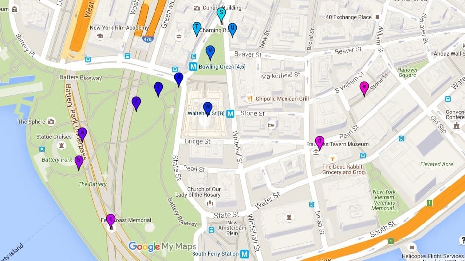
MAP OF BATTERY PARK
Many visitors to NYC, as well as locals, will spend a lot of time in and around Battery Park.
It's the area where the ferries depart for the Statue of Liberty and Ellis Island, but also for the Staten Island Ferry.
Click here to be taken to the larger interactive map to get more details and images on each listed stop, or visit our page on things to do in Battery Park.
MAP OF THE WORLD TRADE CENTER
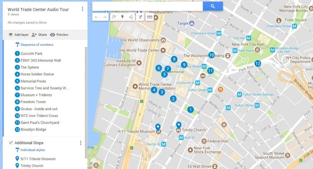
Below is an interactive map of our self-guided tour of the World Trade Center.
You could also download a more extensive version of this tour as a GPS-enabled audio tour.
Click on the map for a larger interactive version
Related Posts


