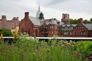
The High Line is one of the most popular and unique parks in NYC with nearly 8 million people visiting it annually.
This special public greenspace, built on an abandoned elevated commercial freight rail line, is on Manhattan's west side.
From this free public park, you'll have amazing views of the Hudson River.
You'll pass by stunning architectural designs, historic buildings, and even public art installations.
It runs through great neighborhoods like Greenwich Village, the Meatpacking District, Chelsea, and Midtown Manhattan.
As a local tour guide with Tours by Foor NYC, I always tell my tour guests that the High Line is a must-see in New York City.
In this guide, I've shared information to help you plan your visit, details on guided tours, a self-guided tour, and tips from locals and travelers.
Here's a wee bit of background.
Before the High Line's development, the abandoned tracks the park was built were an unbearable eyesore.
As a native New Yorker, I never imagined that something so beautiful could replace the overgrown weeds on those tracks.
In 2006, a non-profit organization called the Friends of the High Line repurposed the tracks, eventually turning them into an incredible 1.45-mile (2.33 km) greenspace.
It was modeled after the Coulée Verte in Paris, a tree-lined elevated walkway, also built on an abandoned rail line.
Having been to the Coulée Verte, I must say that the High Line is ten times better!
I know because I've spent lots of time on the High Line, whether leading tours, walking with friends or sitting on a bench reading a book.
It's a special place and I hope you make it to this iconic New York City landmark!
- Plan Your Visit
- Highline Start and End Point
- Guided Tours
- Things to Do on the High Line
- Tips From Locals and Travelers
PLAN YOUR VISIT
First things first!
Below are the High Line hours, the starting points, other entry points and how to get there.
High Line Hours
The High Line is beautiful year-round at all times of the day.
- April 1 to November 30, 7:00 AM – 10:00 PM
- December 1 to March 31, 7:00 AM – 8:00 PM
Many people say that sunset is the best time, but I like it in the evening when the buildings all around are lit and sparkling.
TIP: If you go in the summer bring sunscreen. The sun can be quite strong up there.
In the winter, don't let cold temperatures deter you from going to the High Line.
Do what I do and wear a heavy coat, scarf and gloves and it's comfortable.
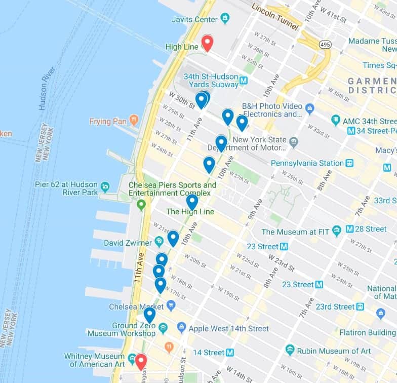
High Line Starting Point
There is no starting point to the High Line because you can access it from multiple points.
So the 'start' of the High Line is wherever you choose to enter.
The northern end of the High Line is at West 34th Street & 12th Avenue.
Its southern end is at Gansevoort St. & Washington St. near the Whitney Museum of American Art.
This is where our guided walks and GPS-audio tours start.
The High Line runs 23 blocks, and there are several access points between W. 14th St. and W. 34th Street
Ideally, you want to walk the full length of the park and should enter at either the southern or northern end.
But even if you can walk along only part of the park, it is well worth the time.
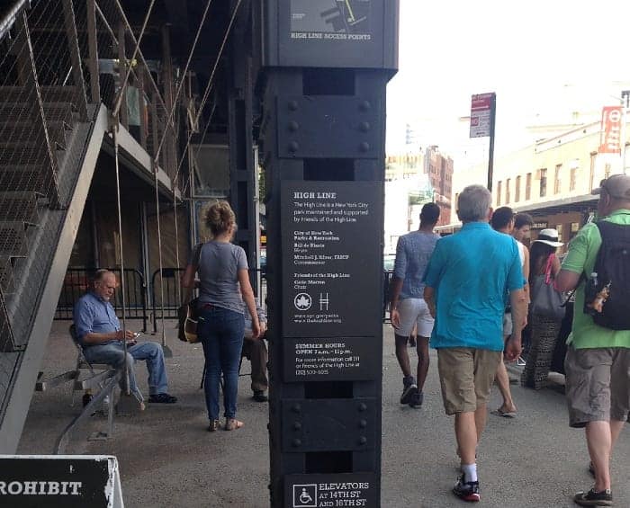
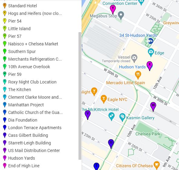
High Line Entry Points
Here is a list of all access points to the High Line. All the access points have stairs. Those that have elevators and ramps are noted.
Click on the map for a larger version.
- Gansevoort Street and Washington Street (elevator access)
- 14th Street (elevator access)
- 16th Street (elevator access)
- 17th Street (temporary access)
- 18th Street (under construction)
- 20th Street
- 23rd Street (elevator access)
- 26th Street
- 28th Street
- 30th Street (elevator access)
- 10th Avenue
- 30th Street and 10th Avenue
- Crossroads Connection (ramp access)
- 30th Street and 11th Avenue
- 34th Street (ramp access)
How To Get There
You can use this Google Maps link for directions from your point of departure.
It is very easy to reach by the subway, so I encourage you to travel that way.
By Subway
- The northern end (map) of the High Line
- A/C/E to 34th St/Penn Station or the 7 train to 34th St/Hudson Station
- Middle of High Line
- C/E to 23rd St. 1 train to 18th St., 23rd St. or 28th St
- The southern end (map) of the High Line:
- A/C/E to 14th St; 1/2/3 trains to 14th St.
New to NYC? Our post, Tips on Using the Subway and Which Subway MetroCard to Buy?, may be helpful to you.
By Bus
- Crosstown M34, M23, M14
- Uptown-Downtown M11, M20
MetroCards work on the buses as well as the subway.
By Car
If you must, you must, but I don't recommend driving to the High Line. Traffic is bad and parking is worse.
Use Google Maps for directions and Parking Panda to reserve a parking spot in the area.
GUIDED TOURS OF THE HIGH LINE
The High Line is wonderful for a stroll, but its fascinating history and the surrounding architecture are what makes this park so marvelous.
If you want more than a simple stroll, consider joining one of our guided walking tours with our personable and knowledgeable guides.
We offer several pay-what-you-wish tours of the High Line including:
- High Line and Chelsea Tour
- Dark Side of the High Line Tour, for a grimmer history of this park
- The High Line is also a part of our All-in-One Downtown Tour as well as our Greenwich Village and High Line Tour.
Self-Guided + GPS-Enabled Audio Tour
We have a GPS-enabled audio tour of the High Line narrated by one of our professional guides.
In the tour, you'll hear some of the same great stories and historical facts you would on our live tour.
Listen to this sample.
Slide Show
If you'd like a preview of what you will see on the High Line, watch our 30-minute slide show narrated by my fellow tour guide Katherine.
TIP: Save more money with a concession tourist pass and be sure to check out our other free, self-guided tours of NYC.
Printable Self-Guided Tour
Here's a downloadable PDF version of our High Line Self-Guided Tour just below.
You can use this tour right on your smartphone or if you want to save battery power and not use up data minutes, you can print it.
The tour takes between 60 to 90 minutes to complete.
SELF-GUIDED TOUR
As I mentioned above, the High Line's history is very engaging. It tells the story of more than a century of NYC's development that continues to this day.
I also spoke of the unique architecture of the buildings alongside the High Line.
As a history lover with an interest in architecture, the High Line is a dream come true for me!
For botanists, it's also a dream come true as there are over 200 species of plants and trees on the High Line.
So many of my tour guests have told me how seeing and learning about the High Line was a unique and satisfying experience.
I hope you'll think so too! Now let's dig in!
Stop A to M
Click here for the complete High Line Self-Guided Tour Map

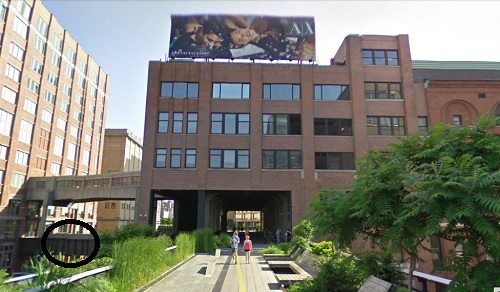
Stop A - Start at the Southern entrance to the High Line
In this photo below, you are looking at the southern tip of the High Line on the left and 812 Washington Street on the right.
The Manhattan Refrigeration Company constructed the building in 1898 with 1.6 million cubic feet of insulated storage space and held four 150-ton refrigeration machines.
Before home refrigeration became the standard, buildings like this were common.
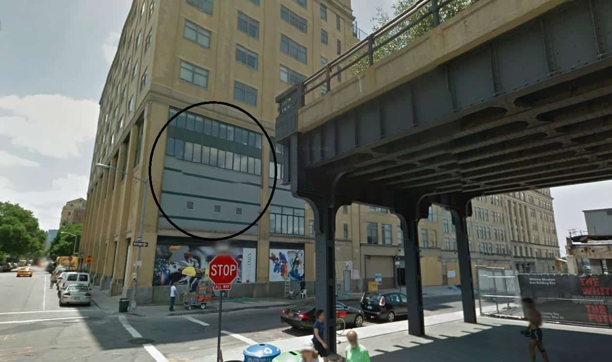
The company carried brine-cooled water supplied from the Hudson River in pipes under West Street to this building.
Everything from fruits and vegetables, furs and, of course, meat, were kept cool inside.
When the rails above were constructed, the company built a section of its complex to allow trains to enter, stop for pick-ups and deliveries and then continue south for 5 more blocks.
The circle shows you where the trains passed through the building.
Stop B - Whitney Museum of American Art
The Whitney Museum is dedicated to 20th-century and contemporary American Art. The building was designed by Renzo Piano.
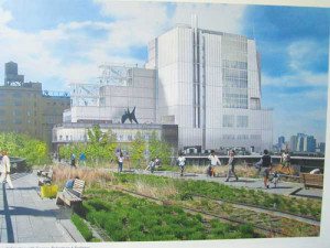
It's 200,000 sq. ft (19,000 sqm) of floor space, including 50,000 sq. ft (4,700 sqm) of exhibit space, a 170-seat theater, a restaurant, and retail space.
In the 1800s, this was the site of Fort Gansevoort, a defensive structure built by the U.S. in preparation for a British invasion during the War of 1812.
It was also once the site of the customs building where Herman Melville, author of Moby Dick, once worked.
TIP: If, like many of my tour guests who want to want to see both the High Line and some of NYC's museums, I recommend entering the High Line at W. 23rd Street and walking south to the Whitney Museum.
If you do go to the Whitney and have a flexible schedule, take advantage of its Free Friday policy, from 5 pm to 10 pm.
Continue walking on the High Line until you come to Stop C.
You cannot miss it as the High Line goes right through it!
Stop C - Gansevoort Market Meat Center
The area around and underneath the High Line is called the Meatpacking District. It runs from West 14th Street south to Gansevoort Street, and from the Hudson River east to Hudson Street.
It was once home to about 200 meat wholesalers and slaughterhouses. Today only a handful of meatpackers remain.
One is the Gansevoort Market Meat Center, though smaller than it originally was.
It ceded space to the Whitney Museum (which moved to this location in 2015) in exchange for a lease extension.
I recall as a teenager here in NYC, my father brought me to a semi-secret French restaurant amidst the slaughterhouses called Florent.
It was the first restaurant to move into the area and many others followed as the meat warehouses moved away.
Now the Meatpacking District is a hub of chic restaurants.
Continue along the High Line on a narrow passage through a thicket of small birch and serviceberry trees (known as the Gansevoort Woodland) until you reach the intersection of West 13th St.
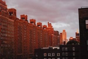
Stop D - Standard Hotel
This large concrete hotel the High Line passes under is The Standard, a high-end hotel with 338 rooms, all with stunning views of the city and the beautiful park below.
When it opened, the hotel's design, with floor-to-ceiling windows, was controversial.
Word got out that the hotel management might have subtly encouraged its employees and guests to put on peep shows in front of the windows. (Read this New York Magazine article).
You may not believe it, but guests have been spotted over the years by High Line walkers engaged in private activity!
I didn't believe it until my friend showed me a blurry picture of someone they spotted in a window!
Look or don't look -- no judgments!
Read the hotel's TripAdvisor reviews.
Continue along the High Line and look to your left. You should be looking at refrigerated trucks (lorries) backed onto low-lying buildings.
Continue along the High Line on a narrow passage through a thicket of small birch and serviceberry trees (known as the Gansevoort Woodland) until you pass underneath the Standard Hotel and reach the intersection of West 13th St.
Stop E - Hogs and Heifers (now closed)

The corner of Washington Street running underneath the High Line and W. 13th Street, was the location of an infamous bar called Hogs and Heifers.
Opened in the early 1990s, when rent in the Meatpacking was still very low, Hogs and Heifers (hogs as in Harley motorcycles and heifers, as in virgin cows) was a neighborhood institution.
It was rowdy and raunchy and always smelled like stale beer.
Attractive and lightly dressed bartenders and a motley crew of patrons would dance on the bar until the sun came up.
Hogs and Heifers became a popular celebrity hang-out in the late 1990s and 2000s. The Beatles' Paul McCartney was spotted dancing in the bar! A bit of Twist and Shout!
Sadly the bar closed in 2019 due to massive rent increases.
Now cross to the other side of the High Line and look out at the view from West 13th Street out to the Hudson River, where you should see the cast iron shell of what was once Pier 54's gateway.
Stop F - Pier 54
Over a century ago, there were piers along a big swath of the waterfront where huge, luxurious trans-Atlantic passenger ships docked.
Pier 54 belonged to the Cunard Line and in 1915, during World War 1, the RMS Lusitania disembarked for England.
It was torpedoed by a German U-boat, precipitating the United States' entry into the war.
When the Titanic sunk in 1912, the RMS Carpathia rescued survivors and brought them to Pier 54.
Today, Pier 54 is the entrance to a park called Little Island.
Now stroll underneath this second building until you reach the intersection of West 14th Street.
Look to your left out to the Hudson River, out to a large greenish-beige structure.
Stop G - Little Island
On Pier 55 is a one-of-a-kind park called Little Island, built on concrete piles (resembling tulip pots) embedded in the Hudson River.
Guests on my High Line tours get a kick out of the unique design, It is certainly Instagram-worthy.
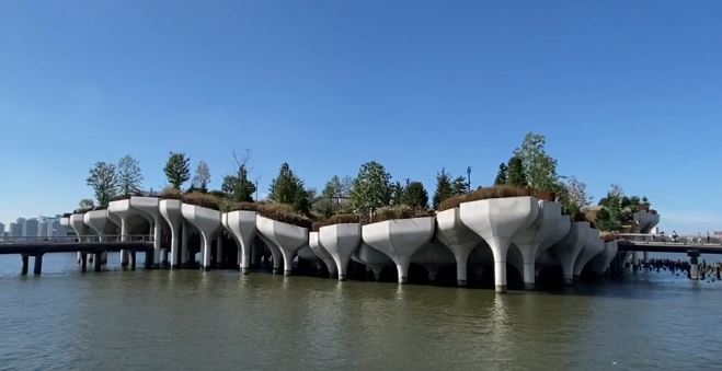
It has great views of Lower Manhattan and offers lots of things to do, many for free.
Read our post on Little Island for more information.
Now look to the right of Little Island. That huge sea green-colored structure is Pier 57.
Stop H - Pier 57
Pier 57 was built in 1952 as a terminal for the shipping and storage of cargo.
From 1971 until 2003, Pier 57 housed New York City Transit Authority buses.
In 2004, the pier was vacated and sat unused until 2023.
After a decade of renovation, Pier 57 opened in 2023 as a multi-use public/private complex.
It’s a terrific spot with a marketplace, restaurant, and several outdoor public spaces.
The free rooftop park is unbelievable! Your pictures will include Little Island and Lower Manhattan.
Continue north on the High Line past a few benches to your right and to a playful water arrangement on your left until you reach the intersection of West. 15th Street.
You are walking through the Diller-Von Furstenberg Sundeck, which contains grasses, perennials, and shrubs, including several wetland species.
Stop I - Chelsea Market
Most of the 22 buildings around W. 14th and W. 15th Streets were built for the National Biscuit Company.
This is where trains brought butter, flour, sugar, and shortening to create the Saltines, Oreos, Fig Newtons, Vanilla Wafers, Barnum’s Animal Crackers, and Mallomars.
According to legend, the Oreo was invented here!
In 1959, Nabisco moved operations to Fair Lawn NJ, precipitating a decline in the area's commercial real estate.
Today, the complex is anchored by Chelsea Market, an attractive hall with some great eateries and shopping.
The remaining floors are filled with tenants like the Food Network, MLB.com, and the local NYC cable station, NY1.
In 2018, Google bought the entire building for $2.4 billion! The company occupies several floors.
Get more information from our Chelsea Market post.
TIP: Just like I recommend to my tour guests, I suggest that if you are looking for some food, grab some to go from the Chelsea Market and bring it to the High Line to dine al fresco!
Now walk underneath the main Nabisco building and look to your left.
Stop J - Southern Spur
The “spurs” of the High Line are curved tracks that veer off the center tracks.
The Southern Spur connected the tracks with the Nabisco Warehouse and the rail cars could go right into the building.
You can still see “NBC” written on the Southern Spur, which stands for National Biscuit Company, Nabisco’s acronym.
Once you come out from underneath, you will be at W. 16th Street. Stand on the left side of the High Line.
Stop K - Merchants Refrigerating Company Warehouse
The railroad tracks that make up the High Line led directly inside this building, which opened in 1918.
At that time, merchants and businesses did not have personal refrigeration systems. Instead, they rented out space in buildings such as this one to keep things cold or frozen.
This is also known as the Northern Spur, designed to evoke the wild landscape that once was common on the High Line.
Continue north along the High Line until you reach a seating area overlooking 10th Avenue.
Stop L - 10th Avenue Overlook
This seating area allows for a rare view of a busy avenue. Pedestrians can sit and rest while looking out at the madness of 10th Avenue.
No matter how bad the traffic, it doesn't even come close to being as bad as it once was.
In the late 19th century, 10th Avenue was known as “Death Avenue". That's just how bad it was!
The streets were so clogged with wagons and pushcarts, not to mention freight trains being hauled down the tracks, that crossing the street was a game of chance.
Hundreds of people were killed on this avenue between 1880 and 1920.
The danger and congestion of 10th and 11th Avenues were key factors in the decision to elevate the railroad tracks.
(I do encourage you to be careful when crossing NYC's wider avenues. At red lights, cars do not stop before the crosswalk! Bicyclists don't stop at all!)
As you walk back up to the High Line from the overlook, you look for a grove of 3 flower maple trees known as the 10th Ave Square.
Look south in the far distance and you can see the Statue of Liberty. She does look rather small!
Continue north until you reach West 17th Street and look out toward the Hudson River on your left.
Stop M - Chelsea Piers
Once a series of piers that, in the 1900s, accommodated the massive ocean liners from the Cunard and White Star Lines.
Today the location is home to the amazing Chelsea Piers Sports Complex, a 28-acre sports and entertainment complex.
One of the original piers, Pier 59 was the intended destination for an eagerly anticipated arrival in New York City.
After the tragic sinking of the ship, survivors were brought to New York on the R.M.S. Carpathia.
While the Carpathia unloaded the survivors further down at Pier 54, the ship first made a brief stop at Pier 59 to unload the lifeboats.
They then continued to Pier 54, where thousands of grief-stricken people waited for the survivors.
The large and strange white building is the IAC Building, designed by Frank Gehry in 2007.
IAC is the parent company that owns Newsweek and Match.com.
Many of my tour guests say it resembles an iceberg. Talk about irony!
Now continue north until you reach West 18th Street and look to the low-lying building on your left side.
Stop N to S
Click here for the complete High Line Map
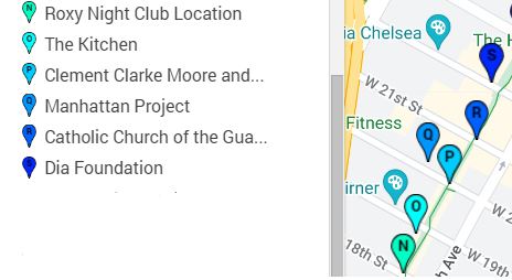
Stop N - Site of the Roxy Nightclub
The Roxy Nightclub opened as a roller disco in 1978 and was described as “the Studio 54 of roller rinks.”
In the 1980s, the club became a venue for hip-hop music and sponsored break-dancing competitions.
The Roxy continued to change with each decade and hosted one of the city’s largest weekly gay dance nights in the 1990s, called “Roxy Saturday.”
Artists that graced the Roxy during this period included Cher, Madonna, Bette Midler, and Cyndi Lauper.
Sadly, this legendary venue closed its doors for the very last time in 2007.
Continue north until you get to West 19th Street. You are now walking through an area known as the Chelsea Grasslands, an area with a mix of colorful meadow grasses and perennials, all chosen to add color and texture throughout the year.
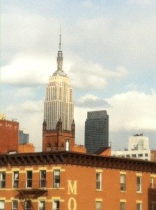
TIP: Along your way, see if you can find the spot to create the optical illusion in the picture on the right.
Look toward the Empire State Building and the short reddish castle-like tower of one of the buildings of the Theological Seminary (Stop O).
Line them up and it looks like the Empire State Building is growing out of the shorter building!
I love showing friends and tour guests this spot. Grab that camera!
Stop O - The Kitchen
On the left side of the High Line look to the street. You are above W. 19th St and on the south side of the street you will see a beige-blonde brick building.
This is the legendary Kitchen, a non-profit art and performance space.
The Kitchen was founded in 1971 and takes its name from its original location, the kitchen of the Mercer Arts Center, where video artists showed their work.
When the organization moved to its current location in 1986, it was considered a bold and slightly odd choice, given that the neighborhood was primarily auto repair shops!
The New York Times said of the move, “This neighborhood will be the next SoHo.”.
The Times was right. Chelsea has surpassed SoHo in the number of art galleries.
The Kitchen focuses primarily on local and emerging artists whose work is experimental in nature.
Alumni of The Kitchen include musicians Phillip Glass and Brian Eno. The band, The Beastie Boys gave an early performance there in 1983.
In 2021, The Kitchen announced an expansive renovation plan and, as of 2025, it is still in the works.
Its temporary home is at the Westbeth Artists Housing, at 55 Bethune Street in the West Village.
If you like avant-garde works of art and performance, I highly recommend you check out The Kitchen.
Continue until you reach West 20th Street and look out to the large red complex to your right.
Stop P - The General Theological Seminary and Clement Clark Moore
We are in the heart of the neighborhood of Chelsea, whose name is derived from the large family estate owned in 1750 by Major Thomas Clark.
He was a British veteran of the French and Indian War. He named his estate after a London hospital that served war veterans.
His estate was passed down through the family and eventually came into the possession of his grandson, Clement Clark Moore.
When the Commissioners Plan of 1811 (which created Manhattan's grid system) was laid out, Clark Moore was extremely opposed to it.
The plan called for 9th Avenue to cut directly through his estate.
Eventually, he realized he couldn’t fight the growing city and he sold off his land in lots to moneyed New Yorkers.
He set aside his apple orchard, however, and donated it to the Episcopal Diocese so a seminary could be built there.
The Neo-Gothic structure was built in 1927 and takes up most of 20th and 21st streets between 9th and 10th Avenues.
Clement Clark Moore’s legacy isn’t limited to the seminary, however.
He composed the poem “A Visit from St. Nicholas” for his children. Today it is known as “‘Twas the Night Before Christmas.”
Stop Q - Manhattan Project Testing
At West 20th Street on the left-hand side of the High Line, look at the north side of the street.
There are three tall buildings that were the Baker and Williams Warehouses.
What is so special about these bland buildings? They secretly stored several tons of uranium in the 1940s!
It was all part of the Manhattan Project, the research and development project that created the first atomic bomb.
Of all of the High Line's stories, I find this one absolutely shocking. My tour guests do too and find it hard to believe!
Have you seen the movie, Oppenheimer? Well, this unassuming place near the High Line was part of the real-life plot.
Continue north until you reach West 21st Street and look to the church on your right side.
Stop R - Catholic Church of the Guardian Angels
If this seems like an odd spot for a church, there is a reason it was built next to the railway.
The congregation had been meeting at a church further uptown.
But when the new railroad tracks were planned, the Church was in the path of the soon-to-be-laid tracks.
The congregation was forced to demolish its building and relocate. The new church was built in 1930 next to the elevated tracks.
Sunday mass was often accompanied by the rattling of trains going by.
Stop S - The Dia Foundation
This multidisciplinary contemporary arts organization was founded in 1974 in NYC to support artists with innovative large-scale projects that were unlikely to find a home elsewhere.
Unlike permanent museums, Dia had several exhibition spaces in Manhattan like SoHo and Chelsea.
In 1987, Dia opened a four-story converted warehouse at 548 West 22nd Street and called it Dia: Chelsea. Initially, 16,000 to 17,000 visitors passed through each year.
In 1997 it bought a second location across the street. By February 2004, attendance had grown to around 60,000. It was time to grow!
Dia bought up three buildings on the north side of W. 22nd Street and work began to consolidate them.
After closing in 2019 for massive renovations, it reopened in 2021. It now has 9 locations in the United States and overseas.
So, I told you the long story behind the Dia. But should you go take a peek?
If you like modern art, then yes! It’s free and the huge artworks are beyond impressive. See the Dia: Chelsea website.
Just exit the High Line at W. 20th Street via the stairs, stop off at Dia and return to the High Line at W. 23rd Street via stairs or elevator.
Now continue north one block to West 23rd Street, where you will reach a futuristic-looking steel and glass apartment building adjacent to the High Line called HL-23, designed by Neil Denari.
The creation of the High Line has been the catalyst for the construction of many new apartment buildings with multi-million dollar units.
TIP: If you plan to take a hop-on-hop-off bus tour, Big Bus Tours stops here at 10th Ave. and W. 23rd Street.
Be sure to read our guide on which New York City bus tour is best for you.
Stop T to Y
Click here for the complete High Line Map
Stop T - London Terrace Apartments
This massive apartment complex to your right on the other side of 10th Avenue was once the largest in the world.
Construction began in 1929 on this complex, which includes about 1700 apartments and an Olympic-sized swimming pool.
The project was headed by Henry Mandel who selected the location for its proximity to Midtown Manhattan.
He wanted to create modestly priced housing for white-collar workers. He met resistance, however, in the form of Tillie Hart.
Tillie was living in a subleased house that she insisted she had the right to be in until May of 1930.
The underlying lease for the house has expired, so Mandel has legal rights to the property. Still, Tillie Hart refused to budge. The construction advanced and all of the houses around hers were demolished.
Tillie held firm. She barricaded herself inside and fended off intruders by throwing bricks and stones at them.
In October of 1929, the police entered her house and moved all of her possessions to the sidewalk out front. She slept inside on the bare floor. The next day she gave in and moved out.
Her house was demolished and the cornerstone for the London Terrace Apartments was laid.
Tillie Hart maybe got a moment of satisfaction, however, when Henry Mandel, the man who had torn down her house, ended up ruined by his building project.
The building, which had cost $25,000,000 to build, fell into default by 1933. Mandel declared personal bankruptcy with debts of $14,000,000 (about $220 million adjusted for today’s inflation.)
Stop U - Cass Gilbert Building
On the north side of W. 25th St is a somewhat nondescript building that was built for the RC Williams Wholesale Grocery Company.
RC Williams had started as a small family store on Maiden Lane in 1809, but by the time this building was constructed in 1927-28, they were prosperous enough to employ one of America’s top architects: Cass Gilbert.
People who are familiar with Gilbert’s other work, such as the Woolworth Building and the Alexander Hamilton Customs House in Lower Manhattan, as well as the US Supreme Court in Washington DC, are surprised when they see this bland building.
It has none of the ornamentations of Gilbert’s better-known works. This was entirely on purpose. Simplicity was the goal here. Gilbert said:
“There is something very fine about a great, gray mass of the building. All one color, all one tone, yet modified by the sunlight or shadow to the pearly gray of wonderful delicacy.”
That’s a good enough explanation for me!
Now walk north to West 26th Street and look left (west) to the end of the block to 11th Avenue.
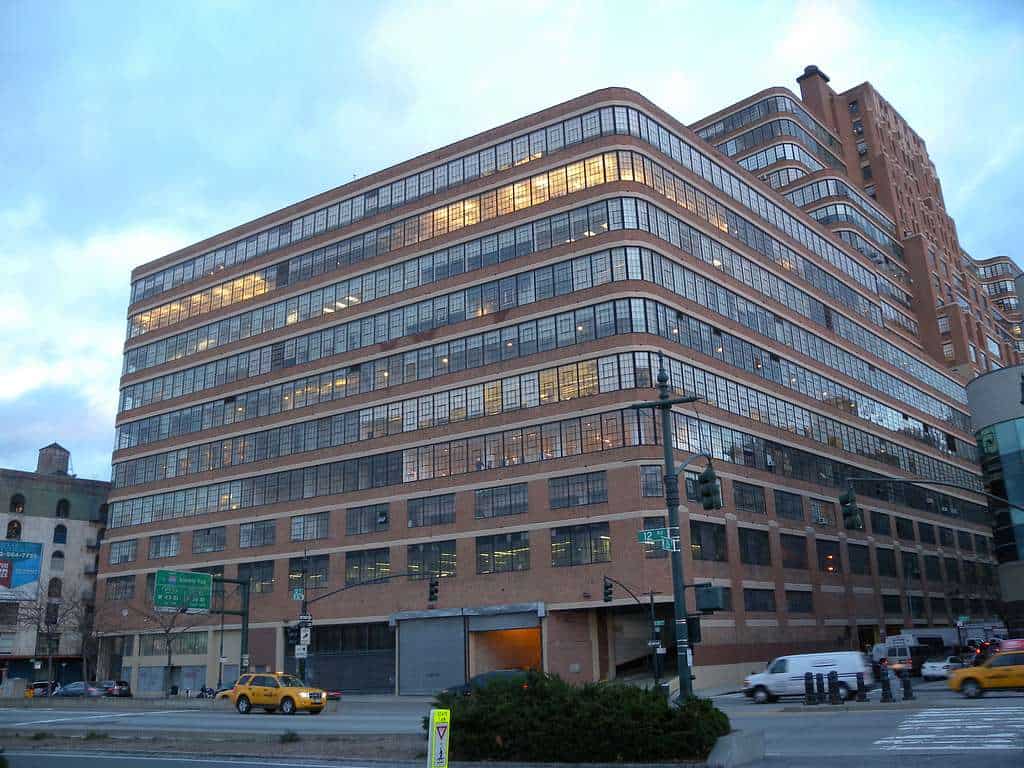
Stop V - Starrett Lehigh Building
This block-long building was a warehouse and freight terminal that opened in 1932. Trains could be driven directly into a space on the ground floor of the building.
This massive structure was a joint venture of Starrett real-estate ventures and the Lehigh Valley Railroad, and the building has 26 million cubic feet of space.
Its lines and rounded edges make it a relatively graceful-looking building, particularly for a warehouse. It is beauty meets function.
The lot that it was built on was also the site of the former Lehigh Valley Railroad freight terminal.
The building hit hard times during the Great Depression. Starrett was bought out, and the Lehigh Valley Railroad held on until 1944 when they too disassociated themselves from the building.
The rail tracks were removed in 1966, and the Helmsley real estate concern bought the building in 1998.
Ownership has changed hands a few more times, but current tenants of the building include Martha Stewart Omnimedia and Tommy Hilfiger USA.
Stop W - US Mail Distribution Center
This is where most of New York’s mail is processed. In 2001 this center had a serious scare when it processed mail that had been laced with anthrax, causing panic in New York.
Though the building is a little worse for wear on the outside, the rooftop has had quite a makeover and is one of the largest green rooftops in New York City.
The Distribution Center sits where the Hudson Railroad Depot used to be.
The Hudson Railroad controlled the lines that went down the west side of Manhattan, and the west side tracks used to be used for both passenger and freight trains.
When Cornelius Vanderbilt bought all of the rail lines in New York, including the Hudson, the west side tracks were designated as “freight only”.
This was because he wanted all passenger lines to go through the new terminal at 42nd St: Grand Central Depot.
Before this switch, however, the Hudson Railroad Depot at West 30th Street had a very famous visitor.
On February 15, 1861, Abraham Lincoln and Mary Todd Lincoln disembarked at the Hudson Depot for his first visit to New York City as the President of the United States. He was greeted by cheering crowds.
Four years later, on April 25, 1865, mourners accompanied Lincoln’s body, which had lain in state at City Hall the day before, to the 30th Street Depot for the beginning of a cross-country trip that would bring Lincoln back to his hometown of Springfield, IL.
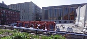
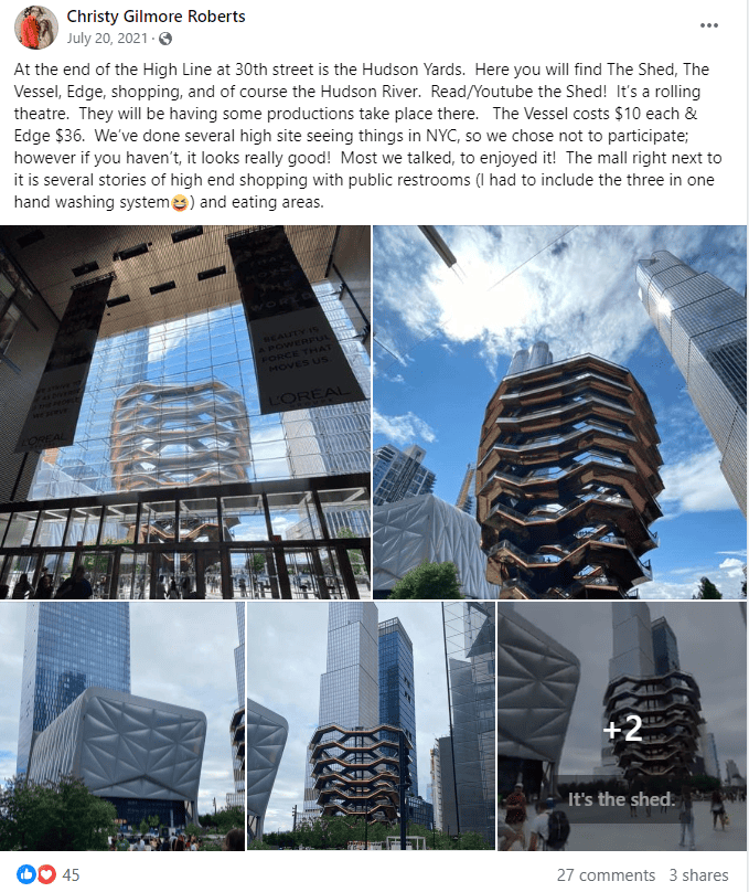
Stop X - Hudson Yards
Hudson Yards is a large commercial and residential complex with a shopping mall and an open space where public events are hosted.
This is where the incredible observation deck, Edge, is located.
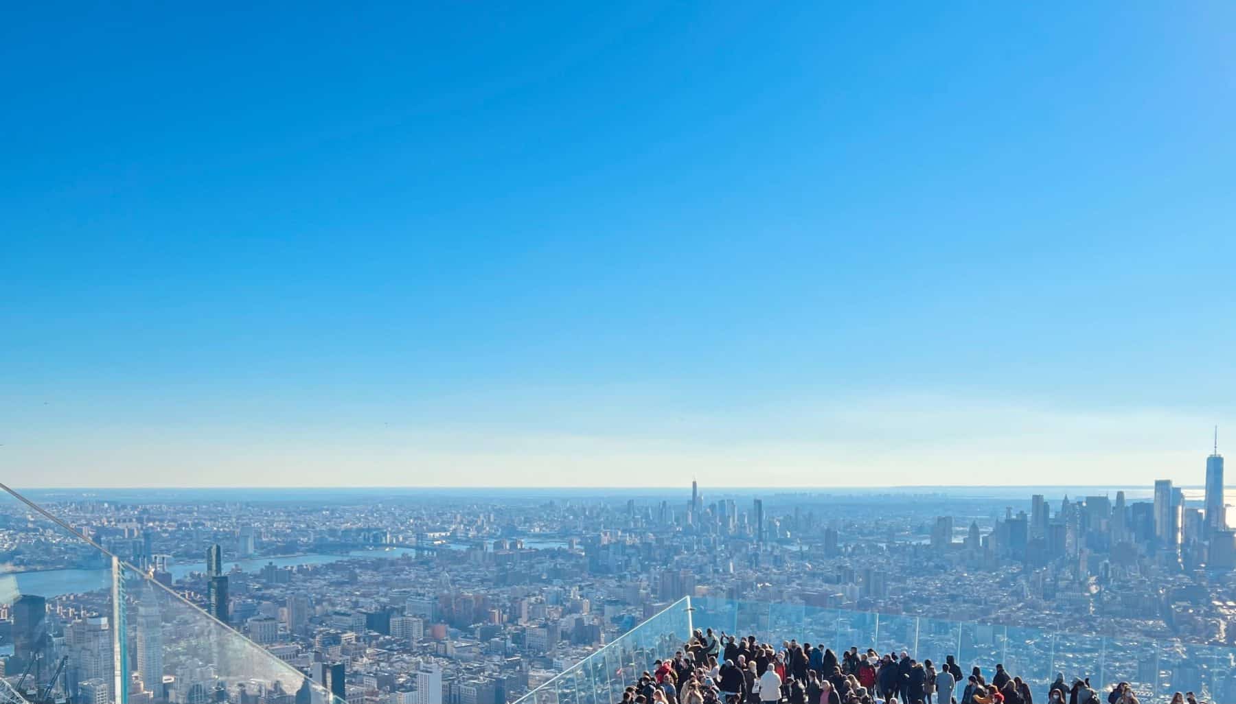
From Edge you can look down and see the High Line, though it looks small from so high above.
Also in Hudson Yards is the unique sculpture/structure Vessel.
HOTELS AND ACCOMMODATIONS
Accommodations near the High Line range from luxury exclusive hotels, chain hotels like Hiltons and Holiday Inns, and cozy bed & breakfast type inns. Prices can range from $125 to $400.
Below are two affordable, comfortable places to stay close to the High Line.
Chelsea Lodge 318 W. 20th St., between 8th and 9th Aves. 212-243–4499.
Perfect for those on a budget and who don’t need a lot of amenities. Restrooms are but each room has its own shower and sink.
If you plan to be out a lot, this is a great choice. Just a block away from the High Line, Chelsea art galleries, and Chelsea Market, the lodge’s location cannot be beaten.
The Jane 113 Jane St. near West St. 212- 924-6700.
An affordable boutique hotel near the southern end of the High Line. During the early to mid-1900s, this small, maritime hotel housed sailors arriving in the ports just across the street.
In 1912, many Titanic survivors were put up here. Today the rooms are modern, but pod-like, with single twin beds. An unusual but highly-praised hotel.
For even more options in the area, check out our post on Where to Stay in NYC.
RESTAURANTS AND FOOD
Near the High Line and neighboring Chelsea, you can find amazing food for not a lot of money!
One of the best and easiest choices for food is Chelsea Market at 9th Avenue between 15th and 16th Sts.
Some other great options are:
- Artichoke Basille Pizza 114 10th Ave. bet. 17th and 18th Sts. This is one of the best pizza places in New York City, with other locations in Greenwich Village and the East Village. Grab a slice of their rich, creamy signature artichoke slice or their traditional red sauce Margherita slice. You cannot go wrong!
- Empire Diner 210 10th Ave. at 21st St. A local favorite housed in a historic train dining car serving up American diner classics.
- Brooklyn Bagel & Co. 286 8th Ave b/t 24th St & 25th St. No need to leave Manhattan to get a great ‘Brooklyn bagel’. Sandwiches and salads are also available.
ART GALLERIES
Around the High Line and Chelsea area, there are more than 300 galleries, most of which are located along the side streets (from W. 20th to W. 27th streets) between 10th and 11th Avenues.
You can find every style and medium of art, from paintings, installation art, sculpture, and more.
The most well-known galleries between the High Line and 11th Avenue are the David Zwirner Gallery at 525 W. 19th St., Hauser Wirth at 511 W.18th St., and Robert Miller Gallery at 524 W. 26th St.
Again, I encourage you to stop by the Dia (stop S on this tour). It is so amazing!
TIPS FROM LOCALS AND TRAVELERS
I think I covered just about all you'll need to know about the High Line, but you might have specific questions you'd like answered that I did not cover above.

Our New York City Travel Tips group on Facebook is the perfect place to look for those answers.
With more than 236,000 members, there's always someone willing to provide help.
Here are a few examples of interesting and helpful tips provided by members of our group.
This visitor wanted to know whether she could start her walk at The Vessel and go to Chelsea Market. Here is what our readers had to say.
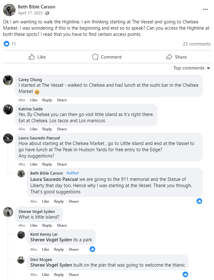
Speaking of... note that the Vessel is currently closed to the public. However, there are still other places to visit in the area.
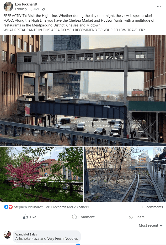
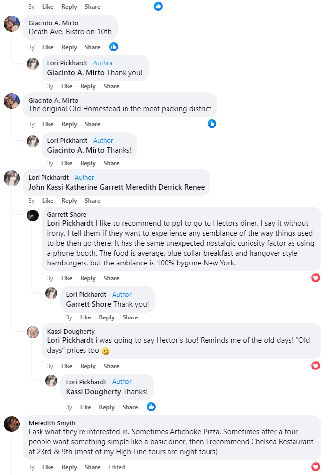
Looking for places to eat in the area? Our readers have some recommendations, a few of which were mentioned above.
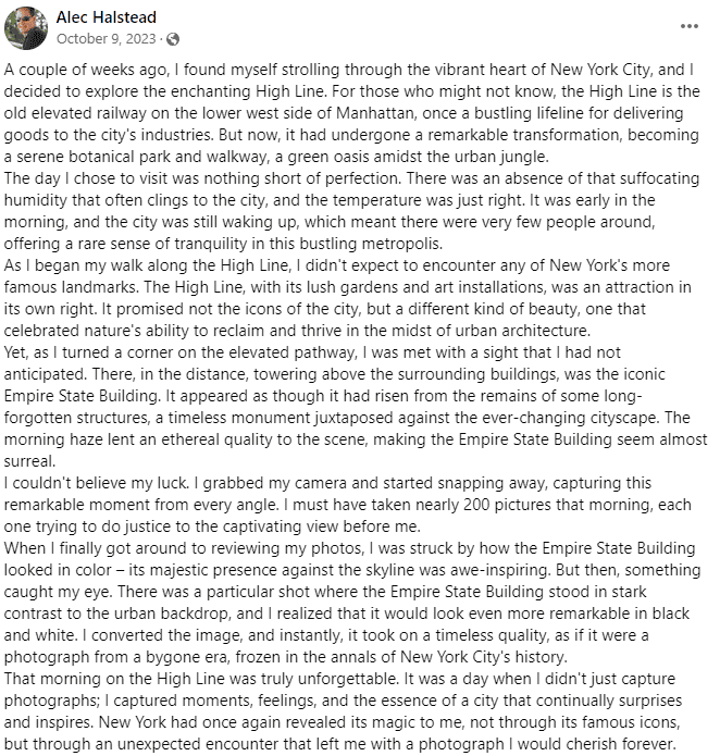
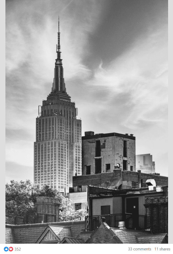
Can you see any iconic landmarks from the High Line? Yes, you can!
This visitor found the experience of walking the High Line magical and memorable.
For even more information about the High Line, or anything at all in the New York City area, please feel free to ask for advice on the Free Tours By Foot New York City Travel Tips Facebook group.
